


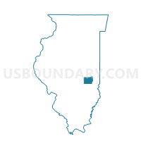
MATTOON 8-1 Voting District, Coles County, Illinois
About
Outline

Summary
| Unique Area Identifier | 564991 |
| Name | MATTOON 8-1 Voting District |
| County | Coles County |
| State | Illinois |
| Area (square miles) | 11.93 |
| Land Area (square miles) | 11.93 |
| Water Area (square miles) | 0.00 |
| % of Land Area | 100.00 |
| % of Water Area | 0.00 |
| Latitude of the Internal Point | 39.50311690 |
| Longtitude of the Internal Point | -88.42682300 |
Maps


Graphs
Select a template below for downloading or customizing gragh for MATTOON 8-1 Voting District, Coles County, Illinois


Neighbors
Neighoring Voting District (by Name) Neighboring Voting District on the Map
- EAST NELSON 1 Voting District, Moultrie County, IL
- MATTOON 5-1 Voting District, Coles County, IL
- MATTOON 5-2 Voting District, Coles County, IL
- MATTOON 6-2 Voting District, Coles County, IL
- MATTOON 6-3 Voting District, Coles County, IL
- MATTOON 7-2 Voting District, Coles County, IL
- MATTOON 8-2 Voting District, Coles County, IL
- NORTH OKAW 1 Voting District, Coles County, IL
- WHITLEY 1 Voting District, Moultrie County, IL
Top 10 Neighboring County Subdivision (by Population) Neighboring County Subdivision on the Map
- Mattoon township, Coles County, IL (15,817)
- East Nelson township, Moultrie County, IL (1,055)
- North Okaw township, Coles County, IL (983)
- Whitley township, Moultrie County, IL (660)
Top 10 Neighboring Place (by Population) Neighboring Place on the Map
Top 10 Neighboring Unified School District (by Population) Neighboring Unified School District on the Map
- Mattoon Community Unit School District 2, IL (23,717)
- Sullivan Community Unit School District 300, IL (7,608)
Top 10 Neighboring State Legislative District Lower Chamber (by Population) Neighboring State Legislative District Lower Chamber on the Map
Top 10 Neighboring State Legislative District Upper Chamber (by Population) Neighboring State Legislative District Upper Chamber on the Map
Top 10 Neighboring 111th Congressional District (by Population) Neighboring 111th Congressional District on the Map
Top 10 Neighboring Census Tract (by Population) Neighboring Census Tract on the Map
- Census Tract 2, Coles County, IL (6,123)
- Census Tract 9769, Moultrie County, IL (4,892)
- Census Tract 3, Coles County, IL (4,656)